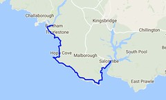
Day Thirty Five - Bantham to Salcombe 20.3km (12.6 miles).
Time on route 5:30hrs, walking time 5:30hrs.
Tuesday 17 January 2017
For the legs south from Bantham I used Kingsbridge as a hub. It was a prompt start and I parked at my B&B in time to catch the 0810 bus from there to Thurlstone. The bus driver only charged me £1 as it was a school run and he said that's what everyone else was charged, even those I was twice the height of the other passengers! Anyway, I then walked a kilometre down to the river Avon to pick up my route from 2016.
I was pleased to see the tea shop I'd found in September was open for a coffee at 0900 so I started my walk with coffee and a view.
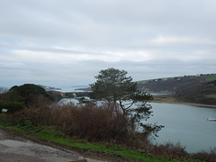
You can see Burgh Island to the left of this photo. So peaceful and still.
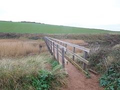
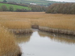
Anyway, once sated I head off into the cold, but calm day. Just past Thurlestone golf course you drop down to South Milton and cross the Ley. This is the second largest reed bed in Devon and you traverse it via a 73m footbridge.
A heron breakfasting.
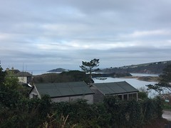
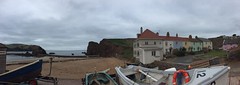
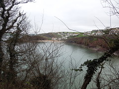
Soon after you enter Outer and then Inner Hope, with the harbour being particularly photogenic.
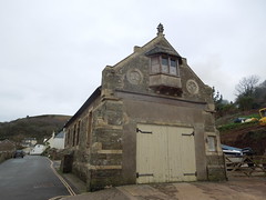
The old lifeboat station had a little treat for me...
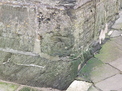
... a somewhat weathered benchmark.
I climbed out and glanced back at Hope Harbour. The pastel coloured cottages make a scenic view.
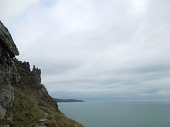
It was a cold day so I didn't linger much, however I had to detour at Bolt Tail. I used to work with the Royal Navy hydrographers and I knew they had a survey point somewhere on this promontory. I even had the National Grid coordinates on me but without a station description (or a GPS) it was a pretty fruitless hunt for a survey marker flush with the ground, positioned 20 years ago and no doubt buried by ground cover by now.
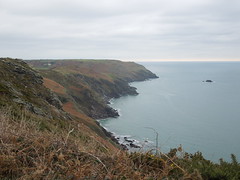
The way ahead was clear and undulating, over Bolberry Down and The Warren (again, another survey marker here - again a failure to find). It's a quiet path with few other walkers and limited refreshment opportunities - fine by me.
I passed Bolt Head and looked back at it from Sharp Tor.
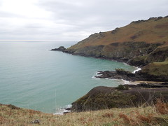
Sharp Tor.
Then around the corner into South Sands.

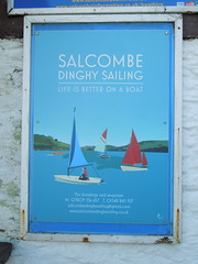
Once past this the path follows (mainly) a road into Salcombe.
I checked out my ferry jetty for the next day. The East Portlemouth ferry departs from a more northerly point in the winter and I always like to check out these things ahead of time if possible.
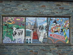
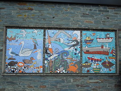
I caught a bus back to Kingsbridge - enjoying their lovely mosaics on arrival.
Kingsbridge is a great hub: buses, a decent B&B (Ashleigh House) and a good choice of restaurants so I dined well and slept like a queen.
Time on route 5:30hrs, walking time 5:30hrs.
Tuesday 17 January 2017
For the legs south from Bantham I used Kingsbridge as a hub. It was a prompt start and I parked at my B&B in time to catch the 0810 bus from there to Thurlstone. The bus driver only charged me £1 as it was a school run and he said that's what everyone else was charged, even those I was twice the height of the other passengers! Anyway, I then walked a kilometre down to the river Avon to pick up my route from 2016.
I was pleased to see the tea shop I'd found in September was open for a coffee at 0900 so I started my walk with coffee and a view.
You can see Burgh Island to the left of this photo. So peaceful and still.
Anyway, once sated I head off into the cold, but calm day. Just past Thurlestone golf course you drop down to South Milton and cross the Ley. This is the second largest reed bed in Devon and you traverse it via a 73m footbridge.
A heron breakfasting.
Soon after you enter Outer and then Inner Hope, with the harbour being particularly photogenic.
The old lifeboat station had a little treat for me...
... a somewhat weathered benchmark.
I climbed out and glanced back at Hope Harbour. The pastel coloured cottages make a scenic view.
It was a cold day so I didn't linger much, however I had to detour at Bolt Tail. I used to work with the Royal Navy hydrographers and I knew they had a survey point somewhere on this promontory. I even had the National Grid coordinates on me but without a station description (or a GPS) it was a pretty fruitless hunt for a survey marker flush with the ground, positioned 20 years ago and no doubt buried by ground cover by now.
The way ahead was clear and undulating, over Bolberry Down and The Warren (again, another survey marker here - again a failure to find). It's a quiet path with few other walkers and limited refreshment opportunities - fine by me.
I passed Bolt Head and looked back at it from Sharp Tor.
Sharp Tor.
Then around the corner into South Sands.
Once past this the path follows (mainly) a road into Salcombe.
I checked out my ferry jetty for the next day. The East Portlemouth ferry departs from a more northerly point in the winter and I always like to check out these things ahead of time if possible.
I caught a bus back to Kingsbridge - enjoying their lovely mosaics on arrival.
Kingsbridge is a great hub: buses, a decent B&B (Ashleigh House) and a good choice of restaurants so I dined well and slept like a queen.
No comments:
Post a Comment