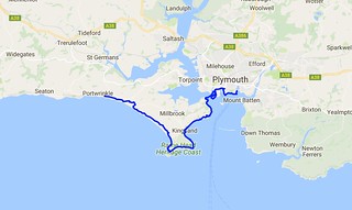
Day Thirty Two - Portwrinkle to Plymouth (Barbican) 26.9km (16.7 miles).
Time on route 7:25hrs, walking time 6:55hrs.
Saturday 27 August 2016
It was my last day in Cornwall today. I arrived back in September 2014 and have taken just under 2 years to complete this county. It's been wonderful: the remote cliffs of north Cornwall, the quaint (oh so quaint!) fishing villages, the tourist honey pots of Padstow, St Ives, Penzance etc, the river crossings (Falmouth - you were complicated) and the amazing places I've found to stay. It's all been immensely memorable and rewarding. So, one last day...
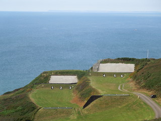
Pretty soon after leaving Portwrinkle you reach the firing ranges at Tregantle. They weren't firing so I was able to walk through them.
All very neat and tidy, tidy and neat. And quiet. Which is just how I like my firing ranges when I'm ambling through the middle of them.
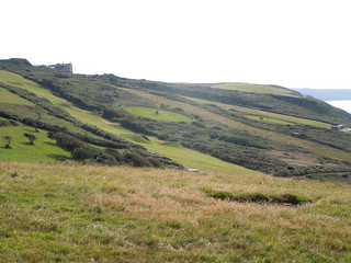
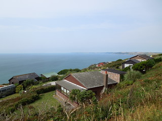
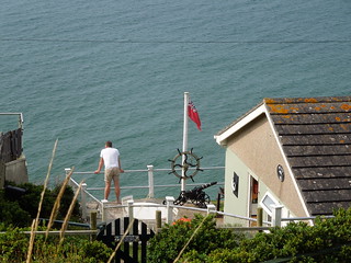
Next up were the Freathy Cliffs. The guide book described the area around Freathy as full of huts, shacks and chalets. I'm not sure when a hut becomes a shack and graduates to becoming a chalet, but the ribbon development beneath the road wasn't beautiful. Just a load of seemingly unplanned buildings plopped on the cliff edge.
Mind you, this chap looked as if he'd sorted himself with his memorabilia.
To add a little irritation the path was diverted due to a landslip but not terribly well signed. So I walked down from the road, through gorse for circa 10 minutes before finding a no entry sign and a weathered SWCP note to say the path ahead was blocked. Yes, I'd passed the sign up the trail saying "path closed" but as the paths criss cross every which way down these cliffs it was hard to tell that it was the SWCP that was diverted. The trudge back up the spiky gorse path was not my best SWCP moment.
I could see Rame Head before me and was keen to get there in 3 hours but with the couple of U turns I'd made I was fed up so plonked myself in the The View cafe for a pep-me-up coke.
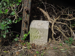
Anyway, onwards. More gorse walking amongst the cliffs. I came across evidence of the MOD's presence here circa 150 years ago - a boundary stone at the delightfully named Wiggle.
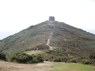
Eventually I reached Rame Head. Poof.
I then turned east and rounded Penlee Point before descending northwards into Cawsand and Kingsand. These used to be in separate counties with the northerly Kingsand being in Devon and Cawsand in Cornwall. The boundary moved eastwards to the River Tamar in 1844.
There is a summer ferry that runs from Cawsand to Plymouth circumventing some of the path. I wasn't even remotely tempted.
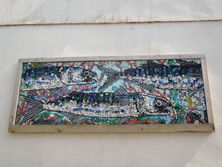
Nice street art made from bottle tops and other recycled finds.
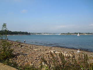
Leaving Kingsand you enter Mount Edgcumbe Country Park and the Plymouth estuary comes into view.
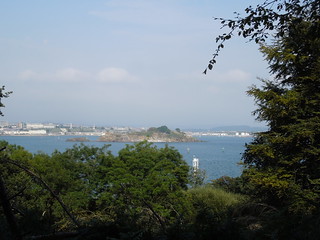
Once again there were path diversions (these ones again not terribly well marked) and I wandered a little unsurely at times. You climb quite high toward Mount Edgcumbe House and, as you do, Drakes Island comes into focus.
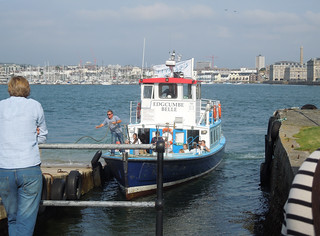
It was a sunny Saturday afternoon and the formal lawns of the Country Park were busy with visitors and some sort of medieval enactment. I pushed on to see if I could catch the ferry which was due in 10 minutes. And I did.
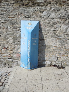
The Cremyll Ferry takes one across to the west side of Stonehouse. As you alight you find a marker for the SWCP.
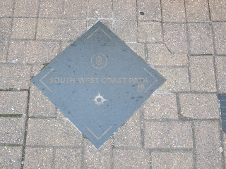
And accompanying you through Plymouth are pavement markers.
Stonehouse takes a while to clear as you sort of circumnavigate it. You head south toward Royal William Yard.
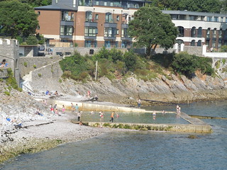
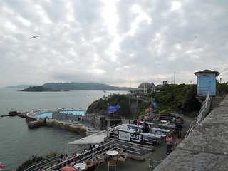
Then southwest, south, east passing a tidal pool.
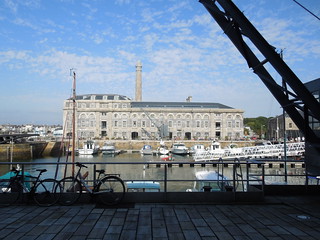
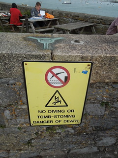
The path then heads directly north coming within about 100m of your earlier route and there is a considerable inland section as you pass Stonehouse Barracks and Millbay Docks. It didn't take long before I was on home ground having lived in this area back in 1990. I pretty much walked within 50m of our first house in West Hoe.
The Hoe is most iconic and has wonderful buildings such as this set of steps.
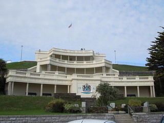
And the lido which was being refurbish back in 1990.
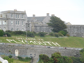
"Welcome Plymouth" announce the lawns of the Citadel. I suspect this is a new fangled modern idea - you can hardly imagine this being an invitation to the Spanish Armada back in the 16th Century.
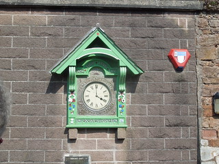
I was looking forward to my daily trig treat. This one being the most unusual trig I know.
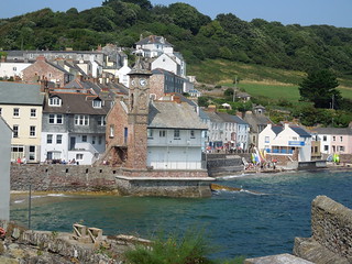
I finished my walk in the Barbican before catching the train home. The next leg promises more urban plodding and then a stroll out towards the beautiful South Hams area. It's good to be back in Devon although I'm going to miss you Cornwall.
Time on route 7:25hrs, walking time 6:55hrs.
Saturday 27 August 2016
It was my last day in Cornwall today. I arrived back in September 2014 and have taken just under 2 years to complete this county. It's been wonderful: the remote cliffs of north Cornwall, the quaint (oh so quaint!) fishing villages, the tourist honey pots of Padstow, St Ives, Penzance etc, the river crossings (Falmouth - you were complicated) and the amazing places I've found to stay. It's all been immensely memorable and rewarding. So, one last day...
Pretty soon after leaving Portwrinkle you reach the firing ranges at Tregantle. They weren't firing so I was able to walk through them.
All very neat and tidy, tidy and neat. And quiet. Which is just how I like my firing ranges when I'm ambling through the middle of them.
Next up were the Freathy Cliffs. The guide book described the area around Freathy as full of huts, shacks and chalets. I'm not sure when a hut becomes a shack and graduates to becoming a chalet, but the ribbon development beneath the road wasn't beautiful. Just a load of seemingly unplanned buildings plopped on the cliff edge.
Mind you, this chap looked as if he'd sorted himself with his memorabilia.
To add a little irritation the path was diverted due to a landslip but not terribly well signed. So I walked down from the road, through gorse for circa 10 minutes before finding a no entry sign and a weathered SWCP note to say the path ahead was blocked. Yes, I'd passed the sign up the trail saying "path closed" but as the paths criss cross every which way down these cliffs it was hard to tell that it was the SWCP that was diverted. The trudge back up the spiky gorse path was not my best SWCP moment.
I could see Rame Head before me and was keen to get there in 3 hours but with the couple of U turns I'd made I was fed up so plonked myself in the The View cafe for a pep-me-up coke.
Anyway, onwards. More gorse walking amongst the cliffs. I came across evidence of the MOD's presence here circa 150 years ago - a boundary stone at the delightfully named Wiggle.
Eventually I reached Rame Head. Poof.
I then turned east and rounded Penlee Point before descending northwards into Cawsand and Kingsand. These used to be in separate counties with the northerly Kingsand being in Devon and Cawsand in Cornwall. The boundary moved eastwards to the River Tamar in 1844.
There is a summer ferry that runs from Cawsand to Plymouth circumventing some of the path. I wasn't even remotely tempted.
Nice street art made from bottle tops and other recycled finds.
Leaving Kingsand you enter Mount Edgcumbe Country Park and the Plymouth estuary comes into view.
Once again there were path diversions (these ones again not terribly well marked) and I wandered a little unsurely at times. You climb quite high toward Mount Edgcumbe House and, as you do, Drakes Island comes into focus.
It was a sunny Saturday afternoon and the formal lawns of the Country Park were busy with visitors and some sort of medieval enactment. I pushed on to see if I could catch the ferry which was due in 10 minutes. And I did.
The Cremyll Ferry takes one across to the west side of Stonehouse. As you alight you find a marker for the SWCP.
And accompanying you through Plymouth are pavement markers.
Stonehouse takes a while to clear as you sort of circumnavigate it. You head south toward Royal William Yard.
Then southwest, south, east passing a tidal pool.
The path then heads directly north coming within about 100m of your earlier route and there is a considerable inland section as you pass Stonehouse Barracks and Millbay Docks. It didn't take long before I was on home ground having lived in this area back in 1990. I pretty much walked within 50m of our first house in West Hoe.
The Hoe is most iconic and has wonderful buildings such as this set of steps.
And the lido which was being refurbish back in 1990.
"Welcome Plymouth" announce the lawns of the Citadel. I suspect this is a new fangled modern idea - you can hardly imagine this being an invitation to the Spanish Armada back in the 16th Century.
I was looking forward to my daily trig treat. This one being the most unusual trig I know.
I finished my walk in the Barbican before catching the train home. The next leg promises more urban plodding and then a stroll out towards the beautiful South Hams area. It's good to be back in Devon although I'm going to miss you Cornwall.
No comments:
Post a Comment