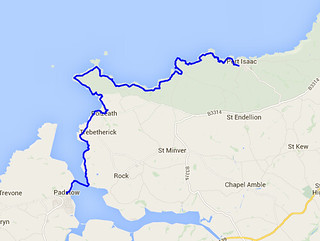
Day Sixteen - Newquay to St Agnes 22.1km (13.7 miles).
Time on route 5:45hrs, walking time 5:20hrs.
Saturday 02 May 2015

I really needed a walk today. A very dear long standing colleague and friend died suddenly last Friday and I wanted some time on the path to reflect. The weather was a bit shabby but I figured that wind and rain would suit my mood.
I parked up in Newquay and picked up the path by Fistral Beach. It was a wet and windy morning and the dog walkers were lone figures out on the sand.

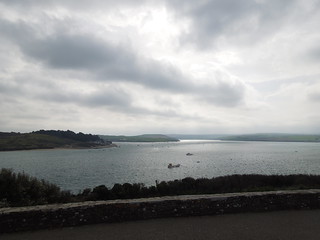
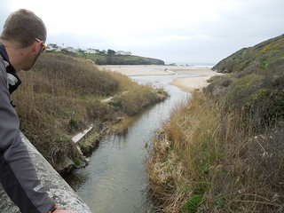
Crossing the Gannel requires planning as the tidal state affects one's route. Fortunately the tide was low and I was able to use the official route across the tidal bridge.


Yup - low tide.

You cross the Gannel and head up Penpol Creek for another bridge.
Walking the coast path in the Spring is a botanists delight. There are simply carpets of primula, bluebells and other flowers whose names I really should learn (should have paid more attention to my Mum when I was younger).

The daisies weren't particularly keen to come out in the drizzle. I know how they feel.

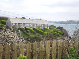
I was most impressed by the garden opposite - that's some mighty terracing.

Unlike my last walk when I had the sun loving creatures as accompany, today I had the rain fan club out in force. This means I basically saw lots of slugs and snails.


After a couple hours of being blasted by the wind and drizzled on by the rain, I stopped at St Pirans Inn, Holywell. I sat on their lovely sofa with a warming coffee and decided to take a selfie.

It was only after checking the photo that I realised I was sitting in front of one of my heros - Shackleton. This is a shot of Adams, Wild and Shackleton 178km from the South Pole. And there I was complaining about feeling a bit nippy...
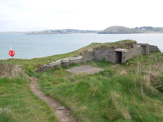
When you climb out of Holywell you pass a MOD firing range. These antenna were arranged in a cross: quite beautiful actually. Perhaps they could enter for the Turner prize?

There are plenty of warnings about unexploded ammunition, dangerous cliff edges and mine shafts.

And not to mention an old friend of mine. So it really was an adder I saw last time.

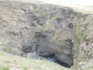
More amazing geology.

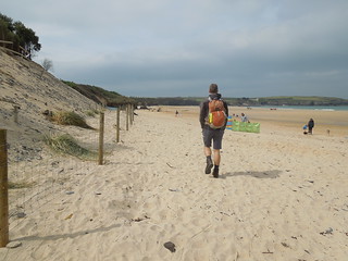
I walked behind the dunes down Penhale Sands. I know you can walk on the beach but the official route is up on the cliff and I am a bit of a stickler for following my rules.

What a mess some people leave behind: who on earth do they think is going to tidy their rubbish up?

I stopped for a late lunch at Perranporth eating my sandwiches on a bench overlooking the sea (the best way to dine) then climbed back out of the village passing a lovely sundial. Now where did I put that sun?

Passing the Youth Hotel I saw a familiar sight for a Cornish washing line.

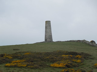
The stretch between Perranporth and St Agnes has much evidence of mining activity. The old shafts have mesh covers to allow the bats who now inhabit them access (whilst keeping others from falling in them).

At times it was pretty barren. I loved the colour of the stone here.

You can see the chimneys of the mines up the valley in Cross Combe. The arty monochrome is totally unintentional and is a consequence of me knocking the dial as I extracted the camera from my pocket.

Cross Combe is the home of the Motorcycle Club.

The rain, which had eased for a few hours, came back and the southerly wind was a bit of a bore as I pushed on to Trevanance Cove. But at least I turned my world back to colour.

I left the path here and headed to St Agnes for the bus home. A beautiful blue bell wood accompanied me on my haul up to the bus stop.

And why the blog title? I thought about my friend Ken a lot today, as I knew I would. I met his wife earlier this week and we were reminiscing, swapping wonderful memories. I asked about the funeral and the dress code. "Oh, smart," she said "but wear something red. Ken loved red." And as I dressed this morning in my usual walking gear I noticed that my base layer, mid layer and waterproof were all in Ken's favourite colour. What a special thought for the day.
Time on route 5:45hrs, walking time 5:20hrs.
Saturday 02 May 2015
I really needed a walk today. A very dear long standing colleague and friend died suddenly last Friday and I wanted some time on the path to reflect. The weather was a bit shabby but I figured that wind and rain would suit my mood.
I parked up in Newquay and picked up the path by Fistral Beach. It was a wet and windy morning and the dog walkers were lone figures out on the sand.
Crossing the Gannel requires planning as the tidal state affects one's route. Fortunately the tide was low and I was able to use the official route across the tidal bridge.
Yup - low tide.
You cross the Gannel and head up Penpol Creek for another bridge.
Walking the coast path in the Spring is a botanists delight. There are simply carpets of primula, bluebells and other flowers whose names I really should learn (should have paid more attention to my Mum when I was younger).
The daisies weren't particularly keen to come out in the drizzle. I know how they feel.
I was most impressed by the garden opposite - that's some mighty terracing.
Unlike my last walk when I had the sun loving creatures as accompany, today I had the rain fan club out in force. This means I basically saw lots of slugs and snails.
After a couple hours of being blasted by the wind and drizzled on by the rain, I stopped at St Pirans Inn, Holywell. I sat on their lovely sofa with a warming coffee and decided to take a selfie.
It was only after checking the photo that I realised I was sitting in front of one of my heros - Shackleton. This is a shot of Adams, Wild and Shackleton 178km from the South Pole. And there I was complaining about feeling a bit nippy...
When you climb out of Holywell you pass a MOD firing range. These antenna were arranged in a cross: quite beautiful actually. Perhaps they could enter for the Turner prize?
There are plenty of warnings about unexploded ammunition, dangerous cliff edges and mine shafts.
And not to mention an old friend of mine. So it really was an adder I saw last time.
More amazing geology.
I walked behind the dunes down Penhale Sands. I know you can walk on the beach but the official route is up on the cliff and I am a bit of a stickler for following my rules.
What a mess some people leave behind: who on earth do they think is going to tidy their rubbish up?
I stopped for a late lunch at Perranporth eating my sandwiches on a bench overlooking the sea (the best way to dine) then climbed back out of the village passing a lovely sundial. Now where did I put that sun?
Passing the Youth Hotel I saw a familiar sight for a Cornish washing line.
The stretch between Perranporth and St Agnes has much evidence of mining activity. The old shafts have mesh covers to allow the bats who now inhabit them access (whilst keeping others from falling in them).
At times it was pretty barren. I loved the colour of the stone here.
You can see the chimneys of the mines up the valley in Cross Combe. The arty monochrome is totally unintentional and is a consequence of me knocking the dial as I extracted the camera from my pocket.
Cross Combe is the home of the Motorcycle Club.
The rain, which had eased for a few hours, came back and the southerly wind was a bit of a bore as I pushed on to Trevanance Cove. But at least I turned my world back to colour.
I left the path here and headed to St Agnes for the bus home. A beautiful blue bell wood accompanied me on my haul up to the bus stop.
And why the blog title? I thought about my friend Ken a lot today, as I knew I would. I met his wife earlier this week and we were reminiscing, swapping wonderful memories. I asked about the funeral and the dress code. "Oh, smart," she said "but wear something red. Ken loved red." And as I dressed this morning in my usual walking gear I noticed that my base layer, mid layer and waterproof were all in Ken's favourite colour. What a special thought for the day.