Day Nine - Sandhill Cliff to Bude 20.5km (12.7 miles).
Time on route 6:00hrs, walking time 5:45hrs.
Saturday 06 September 2014
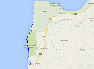
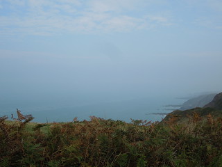
It was a wonderfully hot day on the coast path. The views were constantly hazy blending the sea/sky into each other.
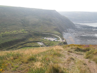
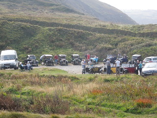
Notwithstanding the heat, it was a strenuous day of ups and downs on this leg. There were 9 river valleys to descend into and climb out of and I ascended over 1km in this walk. My first valley, Welcombe Mouth, was hosting a vintage car get together.
Before I reached the next valley I came across Ronald Duncan's hut, which was open.
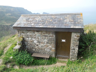
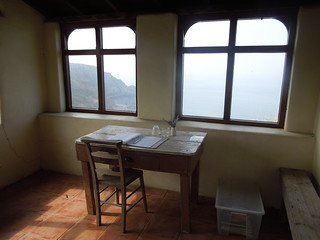
Ronald Duncan was a local author, 1914 to 1982, who wrote many of his poems and plays in this hut. It is a 100m ascent from Old Mill Leat and has an amazing sea view. No wonder he found inspiration here.
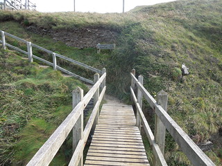
I dropped into the Old Mill Leat valley and crossed the border from Devon into Cornwall. This is the first time I've ever seen a footbridge mark a county boundary. And it's the last time I'm going to walk the SWCP in Devon for many years. It's Cornwall now for miles and miles - or rather kilometres and kilometres.
And, in case you were wondering, yes Devon marks its territory out too. It's on the coastal path direction post.
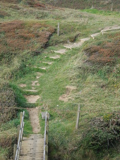
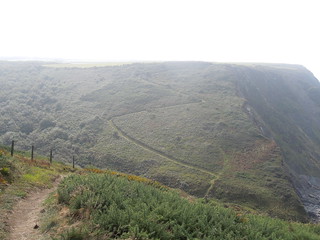
Descending into the next valley, Litter Mouth, I saw my next ascent. Oh the joy.
Each leg of the walk brings different elements of the wildlife to my attention. Last time I was surrounded by butterflies. Today it was blackberries (yum) and fungi.
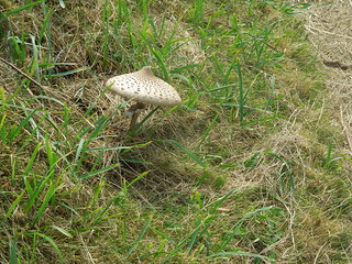
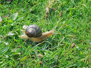
And this little fellow caught my eye.
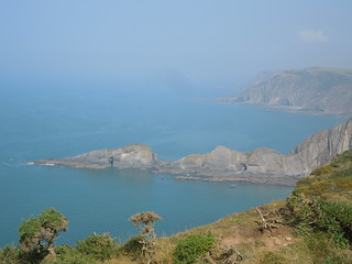
Once out of Litter Mouth the climb up to Cornakey Cliff gave wonderful views of Gull Rock.
The descents and ascents didn't let up with Morwenna, Tidna Shute and Stanbury Mouth all sapping my energy. I didn't even have spare zing to find a trig only 300m off the route (ahem, perhaps the local cows guarding it also dissuaded me?). I seemed to be making slow progress compared to my estimated ETAs at various locations. I suppose I hadn't factored in how much height slows you down.
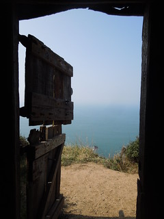
The next attraction on my route was Hawkers Hut. This turfed covered hut was built by the vicar of Morwenstow using driftwood.
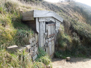
He used it for 40 years as a place of contemplation. With views like this I'm not surprised.
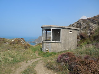
After the next river valley, Tidna Shute, I passed a disused coastguard station.
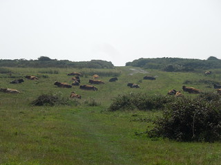
The next feature was the Composite Signals Organisation at Cleave Camp: a site full of radar domes. Between me and the path I came across my familiar nemesis. Big, scary and with horns. The fact that they were lazily minding their own business did little to assure me and I gave them a wide berth (oh the shame).
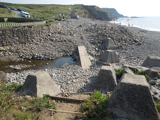
Sustained by refreshments from an icecream kiosk at Stanbury Mouth and then the facilities at Duckpool I trotted south. The next beach was Northcott Mouth and the path actually went across it this time. Often the path crosses the stream/river at a footbridge 50/100m upstream of the coastline, but this time it was great to walk on the beach itself. I sort of feel it's a 'proper' day's walk on the coastpath if I actually set foot on a bit of sand/shingle.
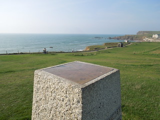
As Bude came into sight something caught my eye. Surely not? This trig wasn't on my map but it certainly had a certain familiar look about it. However, as I neared it, I realised it was a trig-shaped-object, but not the real thing.
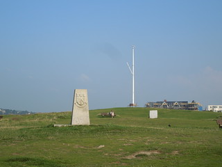
It is a memorial to a local hospital and has a direction finder in place of a spider.
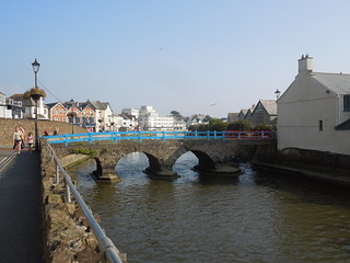
Bude was lovely. The River Neet splits as it enters Bude and has a few bridges crossing it.
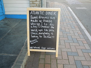
And as I walked to the car this creative sign caught my eye. And now I can't stop humming Eurthymics!
Time on route 6:00hrs, walking time 5:45hrs.
Saturday 06 September 2014

It was a wonderfully hot day on the coast path. The views were constantly hazy blending the sea/sky into each other.

Notwithstanding the heat, it was a strenuous day of ups and downs on this leg. There were 9 river valleys to descend into and climb out of and I ascended over 1km in this walk. My first valley, Welcombe Mouth, was hosting a vintage car get together.


Before I reached the next valley I came across Ronald Duncan's hut, which was open.

Ronald Duncan was a local author, 1914 to 1982, who wrote many of his poems and plays in this hut. It is a 100m ascent from Old Mill Leat and has an amazing sea view. No wonder he found inspiration here.

I dropped into the Old Mill Leat valley and crossed the border from Devon into Cornwall. This is the first time I've ever seen a footbridge mark a county boundary. And it's the last time I'm going to walk the SWCP in Devon for many years. It's Cornwall now for miles and miles - or rather kilometres and kilometres.

And, in case you were wondering, yes Devon marks its territory out too. It's on the coastal path direction post.

Descending into the next valley, Litter Mouth, I saw my next ascent. Oh the joy.

Each leg of the walk brings different elements of the wildlife to my attention. Last time I was surrounded by butterflies. Today it was blackberries (yum) and fungi.

And this little fellow caught my eye.

Once out of Litter Mouth the climb up to Cornakey Cliff gave wonderful views of Gull Rock.

The descents and ascents didn't let up with Morwenna, Tidna Shute and Stanbury Mouth all sapping my energy. I didn't even have spare zing to find a trig only 300m off the route (ahem, perhaps the local cows guarding it also dissuaded me?). I seemed to be making slow progress compared to my estimated ETAs at various locations. I suppose I hadn't factored in how much height slows you down.
The next attraction on my route was Hawkers Hut. This turfed covered hut was built by the vicar of Morwenstow using driftwood.

He used it for 40 years as a place of contemplation. With views like this I'm not surprised.

After the next river valley, Tidna Shute, I passed a disused coastguard station.

The next feature was the Composite Signals Organisation at Cleave Camp: a site full of radar domes. Between me and the path I came across my familiar nemesis. Big, scary and with horns. The fact that they were lazily minding their own business did little to assure me and I gave them a wide berth (oh the shame).

Sustained by refreshments from an icecream kiosk at Stanbury Mouth and then the facilities at Duckpool I trotted south. The next beach was Northcott Mouth and the path actually went across it this time. Often the path crosses the stream/river at a footbridge 50/100m upstream of the coastline, but this time it was great to walk on the beach itself. I sort of feel it's a 'proper' day's walk on the coastpath if I actually set foot on a bit of sand/shingle.

As Bude came into sight something caught my eye. Surely not? This trig wasn't on my map but it certainly had a certain familiar look about it. However, as I neared it, I realised it was a trig-shaped-object, but not the real thing.

It is a memorial to a local hospital and has a direction finder in place of a spider.

Bude was lovely. The River Neet splits as it enters Bude and has a few bridges crossing it.

And as I walked to the car this creative sign caught my eye. And now I can't stop humming Eurthymics!

No comments:
Post a Comment